The Centennial Project

Canada celebrated its 100th birthday 50 years ago, in 1967. To commemorate the event, the Federal government offered funding for civic projects across the country. The result was a legacy of centennial arenas, museums, and even a UFO landing pad built across the country to commemorate Canada’s birthday.

In August 1964 the City of Halifax’s Centennial Committee met to review suggestions for a suitable Centennial project. Local committees were formed across the country to suggest projects, get funding approval and then complete the construction.

The Halifax Committee reviewed the options, and suggested to Council that an aquarium was the most suitable project. They also requested the county be asked to join in. Halifax County had already considered their projects, and in October Halifax county advised they preferred building 3 branch libraries as their centennial project and would not take part.

The city then began a series of discussions about where the aquarium should be located. A waterfront location was preferred, and the Navy’s Central Victualing Depot, or CVD as it was known, was requested from the Navy, however the site was unavailable due to uncertainty caused by the unification of the Armed Forces. In November 1964, City Field or a lot at the corner of Bell Rd and Ahern Street were suggested as possible locations. The city also hired architect Aza Avramovitch & Associates to do design work, for a fee of $35,000.

fullsizerender2-300x107-9570408

Aza Avramovitch was born in Belgrade in 1921; he spent 1941-43 in a concentration camp in Italy, and escaped to Switzerland. He obtained his degree in architecture in Geneva in 1951 and came to Canada in 1953, working in Montreal until 1959. He set up his own practice in Halifax in 1960, and was the architect responsible for the Northwood Centre (Halifax), Church of Christ ( Fairview), the Nova Scotia Home for Coloured Children (Dartmouth), Dartmouth Academy, Shubenacadie Post Office, and several apartment buildings. He died in 1999.

With the city having kicked off the project, it was turned over to a board to look after. On September 21,1965, the Centennial Aquarium board of directors had its first meeting. A Building Committee was appointed, and by the end of May 1966 they had preliminary drawings and a model from the architect.

fullsizerender1-1024x577-8947495

As planned, the aquarium was to be a circular 3-story structure, of about 30,000 sq ft total, constructed of precast concrete. The programming would feature an emphasis on local fish, and the center piece was to be a 2-story, 42′ in diameter Beluga whale tank. The aquarium was viewed as the first piece of a civic square, with a science museum, and possibly a new city hall and performance theater being constructed in the complex. (Bell Road was to have been ended at Summer, and Ahern continue to Sackville Street with this plan.)

fullsizerender-931x1024-6250653

In June, a $184,000 grant was accepted from Ottawa. From the onset, it was believed the project could be built for $600,000; however, some aldermen were concerned about the project going up in price. In September, a tender to build the aquarium was received from Stevens and Fiske construction. The tender came in at a cost estimated at $984,000.

This caused council to go into a heated debate. Discussions were held about the cause of cost overruns, the loss of fees paid to the architects already, and possibly even loss of Federal Centennial money should the project be abandoned. Alderman Trainor also stated:

“Council should not back down at such a a late date unless Halifax wants to be looked at by the rest of Canada as Halifax 1945 and not Halifax 1966, as a progressive city.”

Council concluded the new costs on the aquarium would be $70,000/year in debt payments and could effect the tax rate. Money could be better spent on Summer Games facilities, for a bid on the 1969 Canada Summer games, and two schools. It was suggested that perhaps the $185,000 grant could be directed at a pool. Citizens would get more benefit from it.

The aquarium was seen as a monument to Centennial, civic pride. Alderman AM Butler stated:

“Council should be bold enough, having made a decision in the first instance to build an aquarium, to pursue it, and spend the $300,000, and get on with the job.”

In the end, only Aldermen Ivany, Butler and Trainor voted for the increase in budget, the other 11 against. A committee was sent out to find additional funding to cover the $281,000 overage. They failed, reporting back in November 1966 that the Federal treasury board was unable to produce additional funds despite sympathy from the Minister, and the province was also unlikely to provide additional Centennial funding. The committee suggested building a smaller aquarium, within the original $600,000 budget, then asking the Feds for non-Centennial enlargement funds. The committee also suggested partnering with Dalhousie University, or with the provincial museum.

At the November 1966 council meeting, Alderman Moir gave two notices of a motion for the December meeting. The first, was for a motion to rescind the motion for a Centennial aquarium; the second motion was for a Centennial pool in the Cogswell Street area.

On December 1, 1966, the motion to rescind was passed, the aquarium was dead, and the grant money was to be used elsewhere.

Completely independent of the aquarium project, In Oct 1964 a pool is proposed given citizen demand for swimming in city rec programs. At the April 1 1966 meeting,  $400,000 capital funds are unanimously put forward by council to fund the Aquarium project.

By June 1966 the Recreation and playgrounds commission recommends city appoints architects for design of Municipal indoor swimming pool. The Terms of Reference were approved that September. Mettam Wright Associates was  chosen as pool architects. The initial estimate of the cost for the pool was $400,000. council suggests that in light of cost overruns, the architects fee be set as a percentage of the estimated $400,000 cost, not actual cost of construction.


Echoing the debate surrounding the size of the pool for the Contemporary Canada Games Center, Council debates the type of pool Halifax needs. A 50m pool is required to host the 1969 Canada summer games. Staff estimate facilities for the games would cost city $900,000. In September 1966 the city decided to submit a joint bid for the games, with the City of Dartmouth and the Province.

The the Canada Games bid submitted, in December 1966, a motion to reallocate centennial funds to pool is passed by council. Teh Centennial Aquarium is now the Centennial pool.

there was still some discussion of 50m or smaller pool. the original proposed pool was to be a 82.5’x44′ (25m) lane pool, and separate 35×30′ diving pool. The architect also provided estimates for larger facilities, up to a 50m pool. the cost estimate for this is 700,000. the recreation commission decided this was the best approach

The original design with diving facilities would cost 590,000, smaller options would be fine for recreation, but the Canada games would still require a 50m pool, which was originally thought to be a 300000 outdoor facility on the Arm. A 50m Centennial pool would be cheaper, and better for the city. in addition to the 50m pool, the diving facilities would require an additional 4-6′ in pool depth, and an additional 16′ of head height for the 10m tower. As a cost saving measure, a movable bulkhead is proposed to separate the pools, rather then 2 separate pools.

in the end, it was agreed to proceed in this manner. plans were submitted to council on February 9, 1967 and approved. Final details were worked out, and a call for tenders was issued in April. On May 25th, Council approved a tender from Stevens and Fisk to construct the Centennial pool for $725.183.00


the Side effects of the Central re-development area.

Harbour Drive is one of the more interesting aspects of the city. Its proposal is responsible for the single most awkward urban artifact in Halifax – the Cogswell Interchange. Most people know Cogswell was meant to be the start of Harbour Drive.

The roots of Harbour Drive come from the development community, and a desire to improve transportation in Halifax. Both the post-war plan from 1945 and Stevenson’s 1957 Study enabled the land clearance required to build the highway, as well as arguing for improved transportation.  The 1945 master plan in fact described an elevated expressway starting at Water and George streets, and running to Cunard and Gottingen, finally running to North and Robie. The Central redevelopment area also removed key east west connections in the north part of downtown requiring a new connection.  The Cogswell interchange was required to be built by Contract with Halifax Developments.

In June of 1965, the DeLeuw, Cather & Company of Canada Limited was retained by the city to create a functional plan for Harbour Drive, from the foot of Prince Street to the  corner of Devonshire and Barrington. The plan was completed in November, and called for a 50mph controlled access highway. It was estimated to cost 9.5 million, not including land costs.

The Roadway was planned as a 4 lane divided highway. a 12′ median would be provided, with 8′ shoulders. Interchanges were suggested at Devonshire,  the MacDonald Bridge, and at Cogswell, with a grade separation occurring at  Cornwallis. The report  also a Suggested Building a Second crossing over the Harbour, and a bridge over the northwest arm. A Bridge parallel to the MacDonald, was listed as a possibility, for the second crossing.  The plans called for the expressway to be grade separated through the central business district, with pedestrian overpasses. New modern buildings would replace demolished structures on either side of the expressways. As in other jurisdictions, the expressway was meant to be modern, clean and visually pleasing and orderly.

The following images are from the Geometric design study. This report went on to become the Functional plan, and was also prepared by the DeLeuw, Cather & Company of Canada Limited

img_0996-645x1024-8994275-2097496

Options for Cogswell Interchange

img_0997-699x1024-9763463-4279443

Options for bridge interchange. Note Scheme 3 suggests second bridge.

img_0998-661x1024-8942592-2189175

Devonshire interchange options.

img_0992-768x1024-3942644

Road Profiles at various intersections

img_1006-1024x794-2784696

Road Profile passing under the Macdonald bridge.

img_0995-1024x768-8172104

The  Functional Planning Report for Harbour Drive” from November 1965 outlined the entire full concept for Harbour drive. the proposal actually begins in the North West End of the City – Cogswell was simply the first and only piece to be constructed.

harbourdrive0-752x1024-1020002-4264710

harbourdrive3-787x1024-5965397-4041273 harbourdrive1-767x1024-6890344-3634456

From the beginning there was doubt about the need for such an expressway, and the city’s ability to finance it. City staff pointed out that most of the route would be through blighted areas that were to be cleared for improvement. Approval of the plans was also a prerequisite for the city to secure Scotia Square, as well as a public housing project. This was due to CMHC’s involvement in the redevelopment schemes. An agreement between the city and CMHC required officials to submit the Harbour Drive functional designs months prior to the second stage of Scotia Square construction.

Between 1965 and 1968, various adjustments to the route and details were worked out. City staff had the right of way expanded to 168 feet, but most felt it was too wide, and was cut back down to 70 feet, keeping the project alive. Opposition also appeared from those wanting to preserve heritage properties that would be destroyed by the expressway.

harbourdrive_alignment-1024x629-4219385-5056131

Proposed alignment of Harbour Drive Through Historic Properties

In March 1968, Council approved the Cogswell Interchange portion of the project, despite wide opposition based on the need and protection of heritage. Among the largest proponents were the developers of Scotia Square, who considered the highway a necessity, as it would be the replacement for the streets that were buried under Scotia Square’s footprint. Halifax Developments Limited emphasized that Harbour Drive and Scotia Square must be completed simultaneously.

cogswell_2-1024x802-9600200-7760555

cogswell_1-1024x795-1745620-7191562

Construction Started on the interchange after it was approved – Demolitions hadent even been completed yet.

img_1050-1024x768-9081759

Barrington Street overpass. Note buildings still in the way of the highway..

img_1057-1024x768-1747022

Corner of Cogswell and Brunswick

By 1972 Cogswell would be the end of Harbour Drive. The expressway would end, and funnel through downtown as it does today. The North End expansion would be built as planned. Opposition however was strong, with groups arguing the highway was unnecessary and that it would destroy neighborhoods. In the end, funding couldn’t be found and, combined with enough opposition to make proceeding politically unpalatable, only the Cogswell portion was ever built.

 img_1058-1024x768-8817254

With the development of Scotia Square proceeding, there was now a requirement to replace the Police station. The Police had been housed in the Police and Market building, on the North East corner of Duke and Brunswick St, but this land was added to the central redevelopment area at the request of Halifax Developments.8354002025_cf5d96a6e8_o-52727828354002621_fbcdf20703_b-5741249

The need for a New Police station was first identified in August 1966. In September of that year, the city Acquired a Parcel from the Department of Defense bounded by Rannie Drive, Cogswell St. and Gottigen St. for $176,000. this parcel was originally slated to be used for the new Provincial Court house, but by the end of December 1966, a waterfront location was Confirmed, making this site available.

Nothing happened on the Police Station File until September 1969 when a decision was made to proceed, and the Firm of Graham, Napier and Herbert was selected to Design the Building.


img_1062-1024x768-7200191

Model of the Police Station

img_1067-1024x768-7698342

Rendering of the Building

img_1063-1024x768-1925828 img_1064-1024x768-2262729 img_1065-1024x768-1516364

Redeveloping the Central Redevelopment Area

After Stephenson’s 1957 report, the city of Halifax had defined a central redevelopment area. Between 1958 and 1962, the city focused on acquiring and clearing the land, clearing 17.3 acres by 1962. With Clearance well underway, the displaced residents needed homes.

mulgrave_header-1010x376

Mulgrave Park was one of the direct results of the Central Redevelopment Area land clearance scheme. It was specifically developed to house the displaced people from this area. CMHC was quick to point out that the Central Redevelopment Area in Halifax, was the first project in the country to make use of the 1956 amendments to the National Housing Act, allowing commercial development as long as sufficient suitable housing was provided for the displaced residents. Mulgave Park would be that housing. Unlike previous CMHC sponsored housing projects in Montreal and Toronto, Mulgrave Park would not be located in the central area, and would not be built on the former slum itself.

manning_pool-5656280-4208209

Mulgrave Park itself began as a large estate in the north end. It was destroyed in the Halifax Explosion and sat as vacant land, until it was developed by wartime housing authorities for military use. In 1941, Manning Pool was built on the site.At the end of hostilities, when Wartime Housing was transformed into CMHC, the site became available for further development.

The Mulgrave Park housing project was designed by Ian MacLeman and Maurice Clayton of the Architectural and Planning Division of Central Mortgage and Housing Corporation, in collaboration with Leslie R. Fairn and Associates, and J. Philip Dumaresq and Associates serving as Associate Architects on the project.

mulgrave_elevation-1024x212-1042453

The architects attempted to craft a local flavor to the project –  there was an attempt to preserve the Halifax vernacular with bright colours and low gabled roofs. The project was forced to deal with an 11 acre site, with an 80 foot rise, and loose rubble and fill. Deep pile foundations would be required. The plan called for two 8-story buildings, a 4-story walk up building. and then a series of 3-story buildings. The 3-story buildings would consist of a ground level apartment, and a 2-story maisonette above.  These took advantage of the sloping site, and the maisonettes entered on the upper side of the hill, and the ground floor apartment on the downhill side.

mulgrave_siteplan-1024x579-5285681-6984944mulgrave_units-9805950

The entire project would use a central heating plant. Low pressure steam would be run through radiators in the units. The towers were of reinforced concrete construction. The 4-story walk-up was load bearing masonry construction, with concrete floors. The 3-story buildings consisted of poured concrete construction for the ground floor, with timber framing for the upper floors. 182 parking spaces would be provided – one for every two units.

mulgrave_header-1024x381-1244920-6236785

The slope of the site would require terracing and retaining walls, which were used to define parking and play areas. After its completion in October 1960, the Mulgave Park project won numerous awards for its quality.

mulgrave_view-3037784-8697000

Images below are from the collection of Norbert Schoenauer, McGill University, just after the project opened. It certainly has a modernist aesthetic with a Halifax vernacular vibe to it.

sch03336-1100073
sch03344-8321445
sch03345-6767102

This 1960 opening was over 2 years after the expropriations and demolitions had begun, after the approval of the Central Redevelopment Area in February 1958.  Despite the size of the project, it would not accommodate all the displaced residents, and the slum clearance projects would put stress on other housing projects in the city.

With the Central redevelopment Area land acquired and cleared, it was now time to focus on what to do with it. The city’s director of planning, K.M Munnich, recommended in a preliminary report that a development including high density residential, shopping centre with large department store, and ample parking would be ideal for the site. By 1964, this report had expanded to a draft plan for the area, and included expansion of the area to include lands between Brunswick Street and Grand Parade; Cogswell Street and Rainnie Drive; and the entire frontage of Duke Street. To further guide development, the firm Canadian Urban Economics Ltd was commissioned to do two studies.

The first, the 1965  Central Business District Report, looked at expected growth between 1966 and 1986. It recommended more low and mid-cost housing in the area, and also recommended against expansive retail development, accepting that it had been lost to suburban malls. The preference was to concentrate on office space. The report also called for commercial recreational facilities such as theatres, curling and billiards, and an institutional component of museums, art galleries, a courthouse and a maritime museum, and of course sufficient parking.

In 1966 Canadian Urban Economics Ltd produced their second report, “Central Business District Economic Analysis for Redevelopment Planning”. This report suggested making the waterfront a priority for a new courthouse and the redevelopment of the ferry terminal; developing the Grand Parade from Duke Street to George Street; removing the existing City Hall to make way for a proposed department store; extending the Grand Parade toward the north to Duke Street; making Barrington Street a pedestrian maIl from Duke Street to Sackville Street; redesigning the traffic circulation; and moving parking to each end of Barrington Street.

8867_582780618438789_180586345_n-191x300-7434035

While ever-expanding grand plans for downtown were being made, in January 1962 the city issued a request for proposals for the cleared lands. There was one submission, for the Cornwallis Centre, by Provinces and Central Properties Ltd, developed by the British Woking Group, from Surrey, England, working locally with Napier and Napier Architects .

b7b5y3zciaeusym-1585037

The programme consisted of apartment blocks, which were the first priority, followed by the rotunda and hotel block, office block, market hall, the department store and finally the sports dome. The towers would sit atop a pedestrian podium. The Cornwallis Centre was to be built at grade, with the lower levels housing parking and bus bays. Escalators would bring people into the pedestrian podium.

The proposal included the Cogswell Street Extension, which would bring people into the heart of the centre, via public transit.  Market Street would remain as a service road, but all other streets within the site would be removed. The towers were aligned to preserve views from Citadel Hill. tumblr_ni9wmglgkw1tjuslyo1_1280-9633452

The total estimated cost for the proposal was $48,700,000. It was immediately criticized for being too large and out of character for Halifax. Mayor Vaughan was first elected in the 1963 election, campaigning against the Cornwallis Centre (he was the manager of Halifax Shopping Centre at the time).

The Woking Group was asked to come back with something different.

cc1-1024x726-2964959

Version 2 of the Cornwallis Centre was radically different. Still a multi-use centre, the plan called for 450 dwelling units; a 450-room hotel; a 22 floor office tower offering 264,000 sq ft of office space;  554,000 sq ft of shopping, including two department stores, a grocery store  and a car showroom; and parking for 2500 cars, with space for 600 more in the future. Pedestrians were still kept in a separate landscaped plane from cars, and the only surface entrances were at the hotel.

cc2-1022x1024-1850885

The centre was viewed as the first phase of a comprehensive planning area, so additional improvements in the area of the courthouse and ferry terminal are included. Cogswell Street was also treated differently, passing over Harbour Drive.

cc4-1024x885-3052936

The residential component featured 420 units in three 18 story highrise towers, and 30 in patio terraces that made up a podium for the 3 towers. Parking and services were also held in the podium.

cc6-1024x633-8569548

Apartment towers viewed from Harbour Drive. Page is bent, hence distortion.

The office tower was designed to be just under 300′ in height. It was decided that a single tower of 20 to 24 stories would give more punctuation and drama to the skyline, without impacting the view from the Citadel. Provision for an additional 100,000 sq ft of office space was made via 3 shorter linked towers that could be built later.

cc3-1024x408-7399567

Cross Section. Office Tower on Right, Hotel on Left.


cc5-1024x707-5109344

Overall view looking North. Office tower and additional office space centered. Note City Hall in lower right corner.

This proposal was ultimately accepted, and the city signed an agreement to proceed in October 1963. Time went on however, and no progress was made in the completion of this project. Financing was difficult to obtain and it was felt that things in Halifax had changed, and the Cornwallis Centre was no longer seen as the idea scheme. The city settled with Provinces and Central Properties for breaking the agreement. On April 30, 1965, the city announced another call for proposals for the Central Redevelopment Area.

The April 1965 call for proposals brought 3 responses. Provinces and Central Properties  resubmitted the Cornwallis Centre proposal, Ralph Medjuck’s company Centennial Properties Limited proposed Centennial Square, and Halifax Developments proposed Scotia Square.

Centennial Square was designed by the architects Elmar Tomar Tampold, J. Malcolm Wells, Michael Kopsa, and Henno Sillaste. The four phase development would take 3 years to build, and cost 21.8 million. The proposal was mainly focused on middle income, medium density residential development.

The architects present an interesting collection. Elmar Tampold immigrated from Estonia, and graduated from the University of Toronto in 1953. Henno Sillaste was also Estonian, and graduated from U of T in 1960. The School of Architecture at the University of Toronto had recruited an Estonian architect from Sweden in 1949, and as a result Toronto developed a series of Estonian Modern buildings. Michael Kopsa was from Belgrade, coming to Canada in 1951 and living in Toronto, and built many brutalist buildings including Brantford City Hall.  J. Malcom Wells rejected modern architecture in the mid 60s and went on to become known as the father of modern earth-sheltered architecture.

cc2-1024x493-4182470 cc3-1024x576-5507196 cc5-1024x711-1133014

Besides the residential component,  the proposal contained a hotel and a  moderate amount of retail, designed as an extension of Barrington Street.  A large park – Centennial Square – would be located behind City Hall, and 395 parking spaces and a gas station would be located underneath it. The proposal also suggested closing  Barrington Street north of Buckingham, and constructing Harbour Drive.

cc1-806x1024-7548996

Ralph Medjuck himself presented the Centennial Square proposal to Council, and curiously was also retained to present the Cornwallis Centre proposal which was resubmitted. In the March 2 1966 Mail Star, Medjuck was quoted: “Our smaller Centennial Square proposal is excellent in all respects, but Cornwallis Centre is larger, further advanced, better financed and generally more in everybody’s interest”. The thought, however, was that the Cornwallis Centre was too large, and thus unsuitable for Halifax.

Conversely, criticism of Centennial Square was that it was too simple, and less architecturally unified. The Square lacked pedestrian access; the scheme lacked warehouses, showrooms and recreational facilities. Residential was seen as a positive, but there was a concern that it would overwhelm the market. Centennial Square also left much of the street network intact.

But perhaps the biggest deciding factor, was that Scotia Square would pay the highest taxes to the city. The proposal for Scotia Square was put forth by Halifax Developments.

Halifax Developments was formed in response to the request for Proposals. Its Initial Board was made up of members of the boards from Oland breweries, Bank of Nova Scotia, Sobey’s , NSLP, National Sea Products and Bowater Mersey.

Once formed, Halifax Developments obtained the services of Architect Karl Koch, and Planner David Crane from the United States, and Local architect Douglas Shadbolt. The design would be harmonious through the  use of  similar building types, and grey brick and stone for a consistent feel with the rest of the city. There was a concern to design for the human scale, and not to build massive monuments. The proposal would include 450 residential apartment units, 300,000 square feet of retail space,500,000 square feet of office space in three buildings, a 280 room hotel with conference facilities, a bank and post office, and parking facilities for 1,800 cars complete with gas stations and service centers.


ss_perspective-1026361-3912914

Halifax Developments liked to Compare the Scotia Square development to Place Ville Marie in Montreal. They saw Scotia Square as the first step of elevating the port city to modern metropolitan. The Plan included High density residential on Brunswick Street, which was touted as “one of the most fashionable places to live in Canada to live, second only to Habitat”  It appears as though the the entire Scotia Square complex has its roots in Montreal. The Residential and office component’s were compared to Montreal projects, and the trademart concept was modeled on Place Bonaventure.

ss_plan-7435785

The original Proposal recognized the need for improved transportation. The developers pushed for the construction of harbor drive, But also planed to convert market street to a transit hub – in the original plan, there were to be no entrances of Barrington – users would enter the mall on the upper level from Market (Now Albemarle) Street. The city at the last minute bowed to pressure from Barrington street merchants and left the transit bub on Barrington. – making the Duke entrance the main access to the mall.

Though originally excluded form the slum Clearance area, Halifax developments was able to Get the police and Market building at the corner of Duke and Brunswick, and the block along Barrington between duke and Buckingham cleared and added to the Lot.

ss_cleared-site-3344892-2200524

The proposal was estimated to cost 29,500,000, and was to be completed in 2 phases over 7 years. The Scotia Square Proposal was officially selected on April 24 1966, and Road closures began July 29. Construction was started in 1967.

246663_444106602306192_826911481_n-9085901

The first Portion of the project to be built was the Trademart Building, which is now known as Brunswick place. It was meant to be a place where wholesalers could display there wares – I guess sort of like a Warehouse / mall / tradeshow space. The concept was Modeled on Place Bonaventure in Montreal.

 duketower-1024x766-3185016-4169418
duketower2-1024x760-4868657-3285754523492_445001068883412_1309288776_n-3335364
The next Portion of construction was the Duke Tower and Mall Block, which was approved march 17, 1967. The Trade Mart opened in 1968, and the Mall, Duke Tower and First Apartment building following in 1969. 1973 brought the opening of the Chateau Halifax (Now the Delta Halifax) and plans for Cogswell Tower were developed, opening in 1975 it completed the Scotia Square project.
blogger-image-1197080489-4399514

The 1957 Master Plan for Halifax

Besides architects and planners, the modernist town planning ideas also permeated to social welfare advocates, and politicians. In Nova Scotia, several town planning acts and municipal legislation were passed to allow towns to implement planning and zoning. This local legislation and support from prominent citizens and leaders was as much an enabler of these ideas as the architects and planners.

During the post second world war period, CMHC served as the federal government’s housing arm.Central Mortgage and Housing (CMHC) was formed in 1946 to promote and provide housing for returning veterans. It was a natural change from the wartime housing board, which was created to house soldiers and their families.

m2x00097_postwar031109-9284901

CMHC was set up as a Crown corporation to administer the 1944 National Housing Act.  The act was a piece of legislation that allowed municipalities to enter into agreements with the federal government “to assist in the clearance, re-planning, rehabilitation and modernization of blighted or substandard areas”.  The act also stated that “the federal and provincial governments may assist municipalities in carrying out urban renewal schemes which can include both commercial and residential redevelopment, and residential rehabilitation”.

In its first years of existence, Central Mortgage and Housing, provided mortgage insurance to banks to encourage them to lend money so that people could purchase homes. Later CHMC was also extensively involved in housing design and produced plan books of houses under the Small House Program. (Pictured: CHCH Small House design, look familiar?)

Parliament amended the National Housing Act in 1954. Now properties could be developed for their highest and best use, including commercial uses.  This was  a big difference over previous versions of the act, which only allowed clearance of slum housing to make way for new housing.

The act set out several conditions for federal support:

  • the proposed area must be blighted
  • the project must be in harmony with official community plans
  • make the highest and best use of the land
  • a substantial part of the area must be residential
  • fair provision must be made for dwellings for displaced families
  • the province must approve
  • the municipality must clear the land, the federal contribution will not be more then half the cost
  • the federal government shares in the revenue in proportion to contribution
  • Central Mortgage and Housing will act as agent for the federal government

The CMHC Small house program was begun In 1947. The Small House program was explicit, in that the designs were for modern suburban houses.  The housing program was attempting to be distinctly Canadian, and while borrowing from British modernism, American inspiration was rejected. this meant embracing the garden city ideals and modern planning principles. CMHC was now powered by an amended national housing act encouraging clearance of blighted urban slum areas, and a program to develop and encourage affordable  suburban homes.

img_9467-copy-800x1024-4497694

By March of 1968, there were thirty-seven renewal projects at an estimated cost of $180 million. CHMC Architects and planners  were responsible for the design of many of the projects, including  Mulgrave Park in Halifax, and its prototype, Regent Park in Toronto. It was in partnership with CHMC, that the city undertook Stephenson’s 1957 redevelopment study for Halifax. The partnership was further enhanced by the fact the city’s Development Officer, Robert B. Grant, was a former CMHC official.

Gordon Stephenson was brought in by Halifax Council in 1957 to develop a plan for slum clearance. Stephenson was considered to be an expert in urban renewal and, as advocated by modernists like Corbusier, used scientific rigor to justify his findings. Stephenson was well educated, having studied at the School of Architecture, University of Liverpool, between 1925-1930 and the Institut d’Urbanisme, University of Paris, between 1930-1932.  His time in Paris would have been after Corbusier published “Vers une architecture” (Toward an Architecture, previously mistranslated into English as Towards a New Architecture) in 1923, so he would have been familiar with the work and the ideas it contained. Some sources suggest he worked in Corbusier’s practice.

Prior to his time in Canada, Stephenson also worked in Australia. In the Australian experience, Walter Burley Griffin laid out the capital city of Canberra based on Garden City principles in 1912. Australia was also followers of the City beautiful movement and Stephenson would have been very familiar then with the Garden City, City beautiful, and the other ideas of modern town planning. During his time in Canada, Stephenson served as a planning consultant to the cities of Toronto,  Kingston, Sudbury and Ottawa, Ontario, as well as Halifax, and taught at the Universities of Toronto and British Columbia, between 1955-1960.

It is with this resume, that he was selected by the city of Halifax and CHMC to undertake the redevelopment study for Halifax. In his report on Halifax, he made extensive use of studies and surveys to document the conditions of the city and justify its redevelopment. Stephenson’s report begins with a historical review of the city, and a collection of photographs showing the picturesque areas of the city, and finally ends with blighted neighborhoods.1957nice_views1-3346889-4110862

1957_tenements1-1024x707-8548249-7228563

In Section III, Stephenson begins to describe the problems and proposals for Halifax. He determines that the majority of growth will be suburban, however this will leave the core to remain run-down and blighted. “Here many of the worst dwellings are to be found, and with them social and economic difficulties.”

Perhaps ironically, Stephenson points out what uncontrolled suburban growth will cause:

“…the money to put them right will mount inexorably. It is estimated that it will cost $5000-6000 per house in some places to provide water and sewers to cheap houses which are now laid out in sprawling fashion on rocky land. It was cheap land – but it will be very costly land by the time the community as a whole has paid the price.”

“Clearance and re-development in the city will undoubtedly increase efficiency in the hub of the metropolitan region, and remove some of the slums in the worst parts.”

On the harbour and central area, Stephenson suggests re-developing the ferry terminal area, to bring the harbour into the urban scene, and to provide parking for 300 cars (below).

4373195196_55eb1b0eca_b-3599620
Stephenson calls George Street east of Grand Parade an architectural and financial asset to the city. It is a Wall or Bay Street in miniature. Redevelopment of the western end, however, is strongly suggested. Stephenson goes on to identify the worst end of Halifax as the central area that lies between City Hall and Jacob Street. “With the exception of the blocks between Barrington and Argyle, it is in generally deplorable condition” writes Stephenson. He suggests “the clearing of this area should have the highest priority”. (This area is today Scotia Square.) He goes on to advise that accommodation must be made for the displaced, and proposes a new 4-lane highway connecting Cogswell Street with Water Street to  help speed traffic to the ferry terminal car park, and make the development of the newly cleared site more attractive.
Stephenson identified that most traffic entering the city from the Macdonald Bridge will use Barrington Street. He suggests that Barrington Street “should become an approach road worthy of the city, and that there should be extensive clearance of old housing along its length” with new housing on the western side, and none permitted on the eastern (harbour) side.
The report makes several other recommendations about controlling growth and development on Gottingen and Spring Garden Road, and several other areas.  Stephenson describes Africville as a little-frequented part of the city…described as an encampment or shack town. Buildings and sanitation are deplorable. Stephenson recommends families be rehoused, as the land they occupy will be needed for development in the near future.
The report continues into the scientific study of the city to justify the recommendations. In part 4, he examines the human conditions in the overall city.  By doing this, Stevenson is able to show the study area to be the most densely populated, most crime ridden and unhealthy part of the city. I have excerpted his maps below to focus on the study area.

1957_relife-4463667

Each dot represents a person on Welfare

1957_pop-3452745

Each dot represents 100 people

1957_kid-tb-6370553

Each dot represents a child with tuberculosis

1957_crime-1413790

Each dot represents the home of a child appearing in Juvenile court.


Stephenson basically shows by dot density how bad the study area is compared to the rest of the city. The more dots, the worse the conditions are.  In Part 5, he then goes on to look at the specific structures in the area. Part 5 was completed by a block-by-block survey which was conducted as part of the study.

1957_inadequcy-8909393

The dark areas: 75% or more of buildings are in poor condition with 2 or more major issues

1957_overcrowding-8335915

Houses with more people then rooms are considered overcrowded. The darkest square: 75% or more are over crowded

1957_unsanitary-8826464

In the black squares, 30% or more of dwellings lack indoor washrooms


In parts 4 and 5, Stephenson is able to use scientific factual study to justify the redevelopment of large areas of Halifax based on the human and built conditions of the areas. He then goes on to define several redevelopment areas that should be cleared.

1957_redevelopment-e1438870983789-5761542

Area 6 is what would become Uniacke Square, Area 7 would be cleared and largely remain so to this day, and Area 9 would be Cogswell and Scotia Square.  For Area 6, a new library and playground are recommended. On Area 9, Stephenson writes “There are three proposals for the City Center. The first involves sweeping away the worst housing in the City, which is in the vicinity of Jacob and Market Streets. This would provide excellently placed commercial sites, and a much needed road improvement by connecting Cogswell Street to Water Street on a new alignment.”

Given that he suggests most of the central area be redeveloped commercially,  he acknowledges that additional housing must be located for the displaced people.

1957_overall-2402414

The overall scheme is quite comprehensive. The central study areas are recommended to be converted primarily to commercial and industrial uses. Africville is flagged for harbour expansion (2).  Bayers-Westwood(1), Rockhead Prison (3) and Mulgrave Park (4) are suggested as a site for new housing, as is the area that would become Uniacke Square, and the Ocean Towers. The report recommends re-housing Africville residents at  the Rockhead site.

The report was presented to Council, Approved, and Expropriations and Demolitions in the Jacob Street Area (Which would become known as the Central Redevelopment Area) Began in February 1958.

The Halifax City Archives has the report available online in PDF.

The 1945 Master Plans.

The Master Plan for the City of Halifax was prepared by the Civic Planning Commission in 1945. The terms of reference for the Master Plan were issued in December 1943. The terms of reference were based on “assisting in effecting an orderly transition from wartime to peacetime conditions”.
The commission was made up of 2 architects, George T. Bates, and Harold Lawson. Harold Lawson worked in Montreal. He had several well-known commissions including the Chateau Montebello in Quebec, and locally the Maritime Telegraph & Telephone Co. building on North Street, from 1948.
 The other members included:
  • Ira P. MacNab, NS Board of Commissioners of Public Utilities
  • Mrs F.A Lane, president, Halifax Welfare Bureau
  • Miss K.W Skinner, 1st President, Halifax Business & Professional Womens Club
  • E.F Cragg, Barrister
  • Rev C.F Curran, Parish Priest
  • Allan M. Doyle, President, Cousins Ltd.
  • Frank W. Doyle, Associate Managing Editor, Halifax Herald
  • W Stanley Lee, Director, National Sea Products Ltd
  • Jack B Miller, Inspector, Royal Bank of Canada; President, Halifax Rotary Club
  • A.J Murray, Delegate, Halifax Trades and Labour Council
  • L.E Shaw, President L.E Shaw Ltd.
  • Geo. A Smith, President, Halifax Trades and Labour Council
The Introduction identifies several issues in Halifax, including “the handling of modern traffic in its narrow streets” and identifies slum clearance and housing, street changes and improvements, a vocational school, proper library facilities, and preparation of zoning bylaws as solutions. The report is structurally divided into 2 sections – streets and traffic, and zoning and development. The planning commission which created the report was following modern thought in social welfare, and was definitely using Corbusier’s ideas and theories to modernize the city.
One of the first areas addressed in the Master plan is traffic. On streets and traffic, the report makes sweeping recommendations about how to handle traffic flow, including road improvements, parking improvements, and recommendations for highway and bridge constructions. The overall proposed road layout can been seen in the master diagram blow.  In All, the Master plan makes 20 proposals and 16 recommendations for street and traffic improvements.  The report blames congestion not just on volume, but on poor road design, on street parking which interferes with the free flow of vehicles, and unnecessary interference at intersections.
plan5
The plan makes several specific recommendations for street layouts and road network changes but generally recommends
  • circulation and control of traffic at important intersections by “cloverleafs”, Traffic circles” or other means
  • Strictly regulating Curb parking to permit free movement of traffic
  • off-street parking and loading space provided in business sections
  • streets in future subdivisions be designed to serve type of traffic needed
The first proposal (Proposal one) calls for a diagonal street running from the corner of Water and George to Gottingen and Cunard, then Robie and North. The report also recommend that provisions be made for elevating this highway from Water to Gottingen streets, with rentable space below. (Image below)
In proposal three, the report suggests widening North street into 2 lanes each direction, for provision of the bridge. (Image Below). The bridge location between North St. in Halifax, and Thistle St. in Dartmouth was approved by Dominion Authorities and the British Admiralty in 1933. The report assumed that his would be the location for it, however made reference to the possibility of a bridge in the narrows, recommending that if this is the case, “approaches and thoroughfares leading to it must obviously be in scale with its importance”
Proposals 6 and 7 Were for a set of diagonal streets running from Brunswick street. One road would run from Argyle and Duke, to Brunswick and Jacob – under what would become Scotia Square. the Other road would run from George and Grafton to Brunswick and Sackville.
Proposal 8 was to extend Brunswick Street through to Spring Garden Road. – this was completed at some point, though the proposal was for a straight run through artillery park.
Other proposals dealt with improving traffic flow in the north west end – The current Fairview overpass area was also a problem in 1945, and a new overpass and traffic circle were proposed as solutions.
fairview

Proposal 19 continues Connaught Ave to Inglis as a boulevard, and becomes the principle north south connector across the peninsula to the North West Arm bridge. the North West Arm bridge is intended to assist with the “steady movement of population form the city to the suburbs, both to the east and west, in spite of inadequate transportation facilities” (below)


Improvements are also suggested for the ferry terminal area, for improved passenger and vehicle handling, which had been problematic. The full effect of these roadway layouts can be seen in the Master Plan Map at the top of the post. The use of Diagonals and traffic circles certainly harks back to the Haussmann Plan for Paris .

The master plan also addresses Air and Rail transportation in the city. The master plan identifies the existing civil airport off Chubucto road is inadequate, and recommends that it should be replaced. the 72 acres of airport land should be developed as residential.

The new airport location should be in a low priced land area, Meet the needs of aerial transportation for the next 20-25 years and permit expansion in the future. The report suggest a site west of the northwest arm, which will be easily accessible once the bridge is Built.
The report takes a dim view of rail, and cites Canadian National Railways for carrying out 2 construction programs that Introduced Blight and decay spreading over large areas and blames these programs for reducing residential value. It also blames a lack of planning for there being a North and South end terminal, thought they are not connected across the harbourfront, leaving many areas without sufficient rail coverage. The report blames the north end terminal construction for causing blight in those areas, and then again blames the construction of the south end rail cut, which blighting the south and west ends as well.
The reports recommendations for rail are that
  • modern electric or diesel motive power be used within 10miles  of the city
  • portions of the right of way visible form homes be beautified
  • present train shed, baggage, mail and express facilities be reconstructed
  • Armdale station be enlarged to offer full services.
Rail is blamed directly for being Dirty (Coal burning locomotives were) and causing blight and decay in Halifax. Air travel, still being relatively new, is seen as warranting improvement, and there is no mention of associated noise

The Second Section of the Master plan Deals with Zoning. On zoning and development, the report makes recommendations on divided zones, and rehabilitation of blighted areas. Specifically with regard to slum clearance, the report suggests that this will improve the tax revenue for the city and have even greater value by decreasing the cost for social services. On street changes and improvements, the report states they will add value to neighboring properties and reduce transportation costs and speed up traffic. Right up front the Report recommends that

  • the city be divided into zones as shown on the master plan
  • Vacant areas be similarly zoned
  • All new Sub-divisions conform to the zones
  • That a Zoning Bylaw be enacted.

In the Master Plan, zoning is purported to “promoting more healthful, convenient, orderly and attractive communities, more economical to build and operate, better adapted to the economic and social activities, thus promoting the health, safety, convenience and General Welfare of the Population”

On Business Zones, the report suggests Shopping Centers to cluster vendors of peoples daily needs, and to not let retail string out along the road, “where traffic is a hazard, and abutting properties may become blighted”. It then presents and idealized concept of such a shopping center,appearing to take queues from antiquity with colonnades overlooking a central square. (below)

109f6-untitled-6845893

On Residential Zones, The report suggests separation within residential zones, so that Single Family Homes, Duplexes, and Apartments are kept separate from each other. New developments should be planned as whole communities, and be provided with social, recreational and other facilities as par to fo the plan. The plan for the North Slope is a good example of this methodology. The Report recommends leaving Residential districts alone for the most part, except in 2 areas. These 2 areas, the report states “by reason of blight and obsolescence, should be re-planned and redeveloped”

(G) Redevelopment of Blighted Areas; Recommendation 22

“your commission recommends that the Civic Authorities Directly, or through a legally constituted body of citizens chosen for their ability and experience, undertake with the least possible delay Slum Clearance and Adequate Housing Programs”

Further on in the report, the Commission states

“the Slum is an area where buildings are structurally poor, where sanitation is insufficient, and where overcrowding of buildings on land as well as people into buildings create conditions that affect the occupants physically, mentally and morally to the detriment of not only the slum dwellers, but the city as a whole”

And that

” The Cost of providing Fire, police, medical, social and other services in such areas is always higher then for other sections. on the other hand, the tax revenue form these areas is disproportionately low. the entire community thus subsidizes the maintenance of slums”

B In the Master Plan, the 2 slum areas are defined as the area between the Citadel and North Street, which it is recommended, should be replaced with low rent apartments, due to the areas closeness to downtown employment. The Second area, is considered to be a less bad area around Inglis street in the south end, that should be replaced with apartments, and Commercial fronting barrington to buffer the residential from the industry of the port.

The report then goes on to Africville.”the residents of this district must, as soon as reasonably possible, be provided with decent minimum housing elsewhere.”

The report makes specific mention of the 1944 National Housing Act, which provides funding for slum clearance, and low income housing construction. the report tells “The city council should give leadership in inaugurating slum clearance and re-housing programs, and that at least one project may be launched as soon as possible.

Africville was located north of the railway tracks, along the Bedford Basin in an area known as the Northern Slope. The Master Plan offers a proposal for the re-development of this area, with the removal of Africville, the city prison and the old Abattoir, and the construction of a new residential community.

a5283-plan2-5541563

The proposed street plan is laid out to reduce grades, and provide 700 50′ lots. In keeping with previous recommendations that communities be planed as a whole, a shopping center is provided for, which includes shops, a park, and Community facilities.

50ee2-plan3-2203410

The Master Plan commends the planing work done by Thomas Adams in the aftermath of the Halifax Explosion, and recommends no changes to the rebuilt parts of the North End.

The Plan addresses the North West End, which were described as the under used lands that at the time were HMCS Peregrine, and the Chubucto road air field. The plan suggests that they be planned as a community similarly to the north slope plan, with the assumption that they will become residential. (Below)

104a1-untitled2-9771615

The proposal also recommends the Acquisition of blocks East of Brunswick street for future public administration buildings, including a new City hall, Police Headquarters, central fire station, and Health and Welfare offices. This public administration district would have a commanding position, and “would convert an ugly, untidy,B nondescript section into one of beauty, dignity and utility.

Finally the Master plan gives advice on its execution. The Plan advises that Halifax act on the authority granted to it by the NS Town Planing Act of 1939 (proclaimed in 1943), and assemble a Town Planning Board consisting of the Mayor, 2 Councillors, and 3 citizens, hiring of a planning director, and competent technical assistants, and the creation of a 12 member Advisory committee to advise the Planning board; 3 of the members should be architects.

“the loss of values and the problems confronting the city due to the lack of planning so clearly demonstrate the need for it that no further elaboration is necessary.”

The Plan then suggests that the planning board, in consultation with the city solicitor, Draft a zoning Ordinance, Subdivision Controls, and Implement a Building and Sanitary Code.

With Halifax developing a master plan in 1945, the town of Dartmouth felt it should have one as well, and council approached the Nova Scotia Municipal Bureau and the Department of Municipal Affairs for assistance. The department provided the funding, and the bureau produced the report.

dartmouth-761x560

The actual report was written by architect D.P. Reay and his wife. (The wife is only referred to as Mrs. Reay, and it is noted that she was a graduate architect). The report was limited in scope, and also a part-time effort, as Reay was still in active service with the RCAF. It was to serve as a general plan, with the aim of controlling growth, and serve as a foundation for a larger regional plan at a later date.

dartmouth_cond-1024x703-9815296-7581972

The plan begins with an overview of the history and current conditions of the town of Dartmouth. It highlights the social, economic, industrial and traffic conditions of the town, as well as providing a brief history of the settlement. This section of the report concludes that the main favorable parts of the town are:

(a) a beautiful site, largely unspoiled;
(b) no glaring faults in the land use pattern: the natural industrial zone along the waterfront and the main dwelling areas overlooking the lakes are kept relatively distinct

Unfavorable  features are reported to be:

(a) a high proportion of buildings and dwellings in poor structural condition and poorly laid out;
(b) the sewer system leaves much to be desired in its ability to cope easily with any future expansion ;
(c) a great deal of paving remains to be done;
(d) small playgrounds and parks are inadequate

And finally concludes by stating:

The problem then, is to find the simplest possible way to eliminate existing defects, and to enhance and develop the many inherent and existing advantages, while keeping within the bounds of financial practicability.

The plan makes modest assumptions about growth, assuming it will continue at the present rate, though may be higher if the harbour bridge is completed, and as such the plan should take this into account. The bridge is assumed to change traffic patterns, and the thought is to move residential and recreational zones to the top of the hill, and to leave the harbour front to industry, with road,rail and harbour links.
dartmouth_gen-7745921-3065777The plan recommends 2 main east-west routes coming down and joining with Portland and Octerlony Streets. Combined with Pleasant Street, these will serve as the main circulation out of the residential areas to the town centre. The plan also calls for extending the Lake Banook/Sullivan’s Pond park down to Queen Street, which would be converted to a pedestrian mall, and be the main portion of a commercial and shopping district; and suggests locating the new town hall, library and other civic buildings in this area.

The centre of Dartmouth would then consist of a long formal park strip, some old buildings on Queen Street being  preserved in it no doubt, and leading up from the ferry past the High School to the natural centre of the town just in front of the old dam at the foot of Sullivan’s Pond.

It also recommends the removal of the Starr Manufacturing Building to open that space up for recreation, and provide for a continuous park from Sullivan’s Pond. The plan makes suggestions on improving road layouts should the bridge be built, and then fills in the areas between the roads with new development. These developments are planned to be “pleasant places to live” and not “haphazard developments so common in our small towns and cities”. With this in mind the report suggests new homes be private, with a large lot, and all rooms have a pleasant view to open space. Houses should be away from industry and heavy traffic and railways, with adequate car storage, and stores within walking distance. The grid pattern is rejected, as it consumes additional space reducing taxable development and increasing costs. The report goes on to warn against blight, and how redevelopment of these areas can improve the efficiency of the municipality, warning blighted areas “breed crime and disease, and they are not democratic”.

dartmouth_dev-4543539-7532583The major advantage to a town of a well planned and socially balanced neighbourhood unit, from the financial point of view, is that its virtues are built into it from the beginning in the way of parks, quiet traffic-free streets, convenient shops, etc. There is a place for everything and everything is in its place.

You can read the Halifax Master Plan yourself: here (pdf) via Halifax City Archives. – The Dartmouth Plan is also Available (PDF)


Modern Planning Theory

To understand how we got to where we are, we need to travel all the way back to the mid-19th century, to Manchester, England. At this time, Manchester was at the height of the industrial revolution, and people were moving from the country to the city to work in factories driven by coal powered steam engines.

Friederich Engles was a German, who at the age of 22 went to work in Manchester at a textile mill. On the way he met Karl Marx, and the two become friends. During his time in Manchester, Engles sent Marx several letters describing the working conditions and the general condition of the city.

7fa7bd9a479e626eed5e73bc850c033d
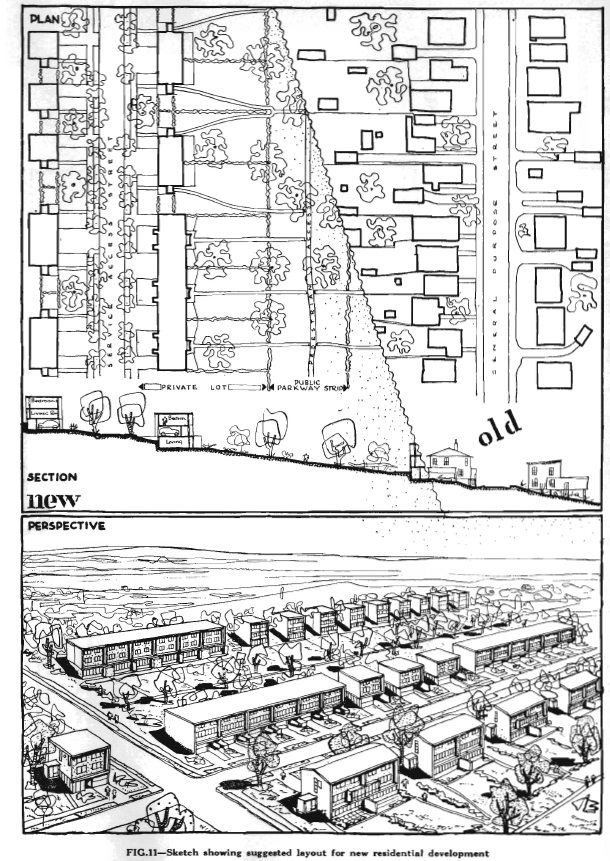
Manchester in the mid-19th century was a dirty, crowded city. The burning of coal, to power the machinery that made the factories run, polluted the air, and soot made things dirty. People lived in crowded housing of low quality – often quickly and cheaply built to accommodate the influx of workers. They worked long hours, and because of the large population living in close proximity diseases spread quickly, resulting in a higher mortality rate among city dwellers then country dwellers.

The conditions in Manchester were so bad, Engles’ writings to Marx were part of the inspiration for Marx’s communist manifesto. Engles himself wrote a book in German titled “The Condition of the Working Class in England” in 1857. (Published in English in 1887.) He argues that people in cities are worse off – they died more frequently of disease and industrial accidents then country people.

Engles’ writing was intended for a German audience who at the time were industrializing, though several years behind England. It was meant to serve as a warning about how not to grow and develop.

Another early urban thinker was Ebenezer Howard. Howard is known for his publication Garden Cities of To-morrow (1898). Though he worked as a court reporter and journalist, he spent much time considering the human condition. He would have likely read the writings of Engles, and have been familiar with the conditions in Manchester.

Howard’s efforts to resolve the human condition attempted to resolve the issues of the city and the country. Howard decided that the city, despite its downfalls, had some advantages. By merging the town with the country the advantages of both can be obtained. He offered the Three Magnets diagram showing the advantages of the Town,the Country and the Town-Country.

8c4c2-howard-three-magnets-5314981

Howard envisioned a city without slums and enjoying the benefits of both town (such as opportunity, amusement and high wages) and country (such as beauty, fresh air and low rents). He illustrated this concept with the Three Magnets diagram, showing the pulls of the Town, the Country, and the Town-country which he described as the ideal. Howard’s Town-country, or Garden City is illustrated below.

eb397-981px-garden_city_concept_by_howard-3741513


Ebenezer Howard proposed a Garden City as the solution to the problems of the city. Architects and planners embraced this idea and worked on concepts for practical implementations. These architects were also heavily influenced by industrial methods and production.

One of the leading urban thinkers was a Swiss architect who went by Le Corbusier. Corbusier published Vers une Architecture (Toward an Architecture) in 1923. The book is a series of essays that had been previously published on the marvels of industrial production. He described mass produced concrete dwellings that could be cheaply manufactured en masse. These consisted of both single family and multi unit developments.

5d58b-corbu1925-3222614-5953173

In 1922 he presented his scheme for a “Contemporary City” for three million inhabitants (left). The scheme was a series of towers in a park,connected with large highways. The influence of industrial production is evident. This scheme was also included in his 1929 book “The City of Tomorrow and its Planning”. Note that on the image on the left are large towers sitting on a podium, which connects buildings to transportation.

Le Corbusier exhibited his “Plan Voisin”, sponsored by an automobile manufacturer, in 1925. In it, he proposed to bulldoze most of central Paris north of the Seine and replace it with towers from the Contemporary City, placed within an orthogonal street grid and park-like green space. It was not well received, though it did provoke discussion concerning how to deal with the cramped, dirty conditions that enveloped much of the city. (Below: Model of Plan Voisin)

830l2-14-46-8115314


In 1929 Corbusier published The City of Tomorrow and its Planning. In it he specifically refers to garden cities, and embraces Howard’s ideals. Corbusier also embraced industry and industrial production. He was fascinated with machines, and the automobile, and he is known for quotes such as “A city made for speed is made for success” and “A house is a machine for living in”.

In the 1930s, Le Corbusier expanded and reformulated his ideas on urbanism, eventually publishing them in La Ville radieuse (The Radiant City) in 1935. This eventually evolved into the Functional City, and the Athens Charter of 1943. The Athens Charter was based on the observations of many cities and was an offshoot of the Congrès International d’Architecture Moderne or CIAM.

The Athens Charter was greatly influential in the Post-war period. The charter stated that:

  • Housing districts should occupy the best sites.
  • A minimum amount of solar exposure should be required in all dwellings.
  • For hygienic reasons, buildings should not be built along transportation routes.
  • Modern techniques should be used to construct high apartment buildings.
  • Buildings should be spaced widely apart, to free the soil for large green parks.
  • It is important to reduce commuting times by locating industrial zones close to residential ones and buffering them with wide parks and sports areas.
  • Street widths and requirements should be scientifically worked out to accommodate the speed and type of transport.
  • Finally, with regards to conservation, historic monuments should be kept only when they were of true value and their conservation did not reduce their inhabitants to unhealthy living conditions.

So now we have seen how Howard’s Garden City ideals have been analyzed and scientifically studied, to result in the Athens charter, which set out the rules for modern planning. At the Turn of the 19th Century, the idea that modern planning and technology, combined with moral sensibility could cure the city of its Ills. This lead to the Board of trade forming the Civic Improvement League in 1905 to Lobby for modern planing and civic beautification. A Campaign in March 1911 was successful. Launched by Robert Hattie, the revived campaign by the Civic Improvement League included A lecture series, newspaper articles and proposed plans were all presented.

Various Design Schemes were presented, including the boulevarding of Morris St, grand parks at fort Needham, A Bridge over the Northwest Arm, and ferry terminal improvement. The illustrations were done by Architect Andrew Cobb, and the grand buildings were neo-classical in style, as preferred by city beautiful. The city beautiful movement was primarily a North American implementation of the garden city ideas, but was slightly different in its outlook. The City Beautiful movement was concerned with introducing Grandeur and beautification to cities and promoting beauty not only for its own sake, but also to create moral and civic virtue among residents. the City beautiful movement was using design to elevate the social well being of the people with superficial changes to the environment. The garden city was about using design to directly improve peoples lives by removing them from unsanitary conditions. The City Beautiful movement also took hold in Australia.

untitled2 untitled1 untitled3 untitled4

Among the Lecturers was visit from British MP Henry Vivian, who commented that the slums in Halifax were far worse than those found in Britain, and that such conditions would never be tolerated there” he also presented on the garden city. Another lecture, presented by Thomas Mawson, a British landscape architect and planner was attended by Nova Scotia MLA for Halifax County George Faulkner. It was Faulkner who introduced the Town planning act to the legislature 4 months later.

The Nova Scotia Legislature passed the first Town Planning Act in 1912. The 1912 act was largely based on the 1909 British act. That first act however was short lived, and while it enabled municipalities to enable planning, it did not require it. and was replaced in 1915 by a new act written by Thomas Adams. Adams was pioneer urban planner. Born in Scotland, he was secretary to the Garden city association. In 1914 he took the position of town planning adviser with the federal Commission of Conservation. As part of a federal advisory commission, he had no ability to legislate land use federally, so he undertook a tour of the provinces. in Feb 1915 he stopped in Halifax, and found the 1912 act to be insufficient for the needs of the city. he then worked with city reformers to update it.

The 1915 Town Planning Act required cities to setup town planning boards, and to develop planning schemes. the act enabled munciplaities to purchase, sell and lease land, and the authority to approve or reject development of roads and buildings. Halifax Formed its town planning board in 1916, led by Robert Hattie, who recruited Thomas Adams to Develop plans. Hattie, Adams, and the City engineer Fredrick W. Doane developed the First plan for Halifax, separating the city into zones.

A large residential district was proposed along the Northwest Arm. As Estate owners passed, their estates were subdivided. In the Plan below, The Estate of Roderick MacDonald has been subdivided forming Rockliffe Street running between South St. and Oakland Road.

Adams work was interrupted however by the Halifax Explosion. Working with the Halifax Relief Commission, Adam’s Garden City ideals were crucial in the development of the Hydrostone District. With the Hydrostone Complete in 1921, and most of the devastated area under the Control of the Halifax Relief Commission, there was little work for the Town Planing Board. They developed a proposal for Connaught Ave to Parallel the new South End Rail Cut which was rejected by residents, but basically moved from a forward thinking body to one which began to arbitrate disputes and approve development.

Lack of interest, and Economic downturn led to planning stagnation throughout the 20’s and 30’s. It looks as though the Board didn’t formally meet between 1922 and 1931, and then only 4 times between 1931 and 1937. after the financial crisis, The second world war happened, which caused massive unplanned growth in the city. Halifax’s first modern urban plan was finally created in November 1945.

A foot Note.

Also of note, is that in 1910 City Alderman Clarke proposed slum clearance in the area of what is now Scotia Square. he also suggested some improvements to the road layout.untitled